Rotating Closure Signs & Reasons
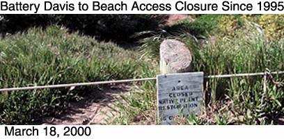
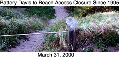
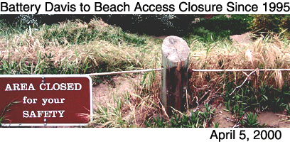
Here is a typical example of the trouble with the Fort Funston closures. This lovely large parcel of land, including also a chunk above and to the left behind the trees, was closed in 1995, without public input, for the express purpose of native plant restoration. Native plant restoration was NOT done and the site continued to be shut off from public use. Now that this has been brought to light through the lawsuit and publicity, just in the past month the native plant signs have been removed, and a few days later replaced by signs claiming a safety need. This is evidenced in the photo sequence on top, all photos taken at the "L" corner on the Sunset Trail near the new bench that faces out to sea.
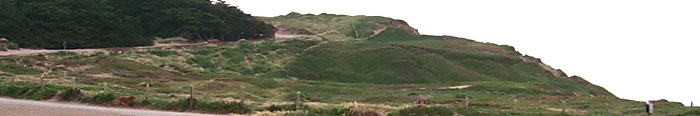
You can see from the photo above that most of this land is set way back from the cliffs, so what is the safety issue here? It's hard to not make fun of a process that is so transparent, but at the same time it is deeply maddening that so much public land has been shut off for reasons that clearly aren't valid.
To
First Section of Fort Funston Forum