![]()
![]() News,
opinions, announcements, documents and images about Fort Funston's future.
News,
opinions, announcements, documents and images about Fort Funston's future.
Bluff Failures on The Sunset Trail
"In order to carry out our mission, we must ensure that park sites are physically accessible to all. We take our mission seriously and strive to ensure that those with disabilities can enjoy the resources that make this park special..." ........ "We approach accessibility in many different ways, and welcome input from visitors and experts in the field as well as from our park staff." ........ "The EOC [Equal Opportunity Committee] mission statement includes the park serving as a National Park Service model when complying with the Americans with Disabilities Act (ADA), and ensuring that accessibility standards are met or surpassed parkwide at all facilities and in all programs." - G.G.N.R.A. General Superintendent Brian O'Neill
all of above in: Park News, Fall '99 G.G.N.R.A. magazine: www.nps.gov/fopo/parknews/fall99/parknews.htm
"Accessibility: Fort Mason Center: with advance notice, arrangements can be made for people with mobility impairments and wheelchair users, (415) 441-5706. Fort Point and The bookstore: video screening room and rest rooms are accessible. Muir Woods National Monument: all paved trails are handicapped accessible. Alcatraz: rest rooms at the dock and at the top of the hill are accessible, as is the main level of the cellhouse. The Blue & Gold Fleet, the ferry ride is accessible. SEAT (Sustainable Easy Access Transport) vehicle is available on Alcatraz for accessible transport to the cellhouse. Presidio: visitor center, main post walk and Golden Gate Promenade are accessible. Crissy Field: portions are accessible. Fort Funston: wheelchair accessible, loop trail. Cliff House: limited accessibility."
- from main page of G.G.N.R.A. website at: www.nps.gov/goga (bold added)
Oh....., Wheely?
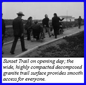
The Sunset Trail is an important and very popular section of Fort Funston. For many people visiting the Fort for the first time, it's their Main Street. It heads right out from the parking lot, towards a beautiful view of the coast and the Marin headlands. It's long been used by dog walkers, tourists, whale-watchers, folks interested in its historic gun-batteries -- and especially by people with wheelchairs and strollers, because it's a paved trail. Or, rather, it was paved. Then out of the blue one day early this year, the Sunset Trail was closed, apparently for good, if not for good reason.
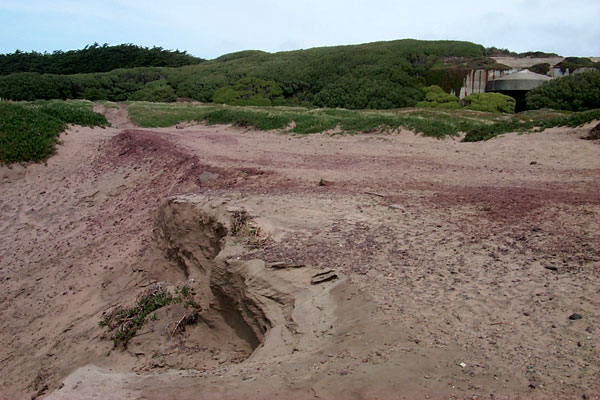
In the "Declaration of Mary Gibson Scott in Opposition to Temporary Restraining Order" starting at paragraph 12 on page 3 and continuing through the verification paragraph and signature the declaration reads: "12. A portion of the Sunset Trail was closed due to failing and eroding pavement on an emergency basis. It was reopened on March 9, 2000, following the removal of a 1,200 foot unsafe section of paved area which was undermined by bluff failures. Two benches were removed because they were unsafe and in a deteriorated condition. It is anticipated that the benches will be replaced by March 31, 2000. I declare under penalty of perjury, that the foregoing is true and accurate to the best of my knowledge. Dated this 13th of March, 2000 Mary Gibson Scott"
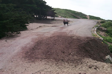
This photo was taken after the recent removal of the pavement on the Sunset Trail. It shows the one small area of roadway erosion on the entire trail. Do you have any photos that might help establish the true condition of the pavement and benches last fall? Please click here to let the Fort Funston Forum know! Thanks. - Editor.
The Bureau That Cried Wolf
A Funston Fable
Once upon a time, there was a big bureaucracy that was in the habit of doing just whatever it felt like. The big bureaucracy didn't like having to tell anybody, even the people who loved to come visit it all the time, what it was going to do. But even the big bureaucracy had to sometimes appear to follow the law, so from time to time when its actions were hard to explain, it began to yell at everyone who would listen, "Emergency!" At first, everyone was very careful to heed these warnings of the big bureaucracy, even when its actions didn't seem to make sense. Surely, they reasoned, in an Emergency! everyone ought to listen to the warning and do exactly as they were told. But, as time went on, there kept being more and more Emergencies! One time, a road with just a teensy-weensy spot that needed to be fixed, was ripped out of the ground from one end to the other! Nobody knew why this happened, and it was said that the road was going to be closed for ever and ever. The people who loved to come visit knew that road, and they could not see any kind of Emergency! about it or why it should be torn out and closed. They began to talk amongst themselves, and even began thinking for themselves based on things they saw with their own eyes! "Sometimes when the big bureaucracy shouts out, 'Emergency!', it's just saying that; it doesn't really mean it!," said one of the visitors. Another replied, "It can't be bothered to explain itself all the time, it's a big bureaucracy!" Every year in the springtime, a colony of bank swallows would fly thousands of miles north to have their babies at the place where the people loved to visit. Even though everyone knew this was going to happen in the springtime, some people whispered that the big bureaucracy was going to shout, "Emergency!" when the swallows arrived. Then it would be able to keep all the people far, far away from the swallows who came back every year to where the people also came to visit. After a while, nobody even paid any attention when they heard someone shouting, "Emergency!" That was a very bad thing, because once in a very long while, at the place where the people and the birds loved to come visit, a very real and scary emergency would indeed happen. The people should have listened to the big bureaucracy at those rare times, and been very careful to do do as they were told. But it was too late. By that time, nobody would even turn around when they heard the word, "Emergency!"
by Michael B. Goldstein
Why was the Sunset Trail closed, whereas other erosion damage remained simply shored up --
or ignored?
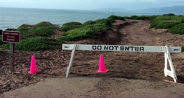
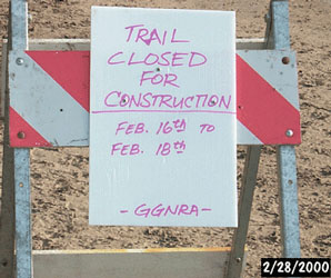
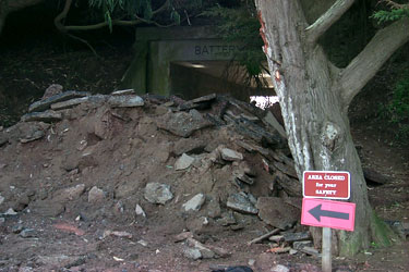
For quite a while areas were closed without notice, explanation, opportunity for comment, or future plans given. When notices were posted, they often didn't match the current date or situation. Here, outside the northern Battery Davis entrance road, a three-day closure sign remained in place ten days after the work was to have been completed, as the camera's date stamp indicates.
How much money was spent to tear out and move around this asphalt? Why was it considered OK to simply shut down a major trail, one that the GGNRA itself mentions on its own website as being noteworthy for its accessibility?
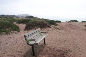
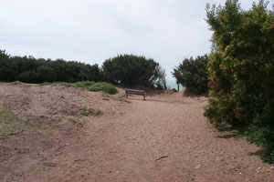
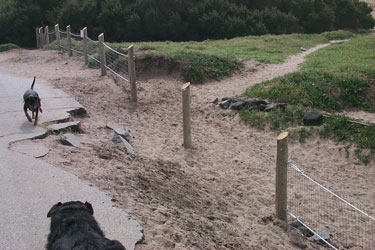
Now, and only thanks to strong protests a few weeks ago, the Sunset Trail is said to be "open" -- with new benches, which weren't needed -- but it's not open to most people who use wheelchairs or strollers, because of the uneven surface and deep sand.
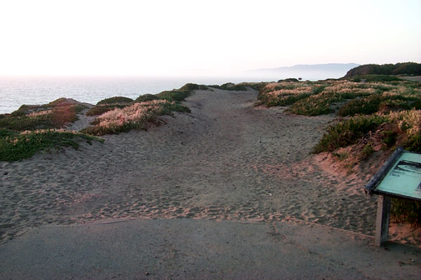
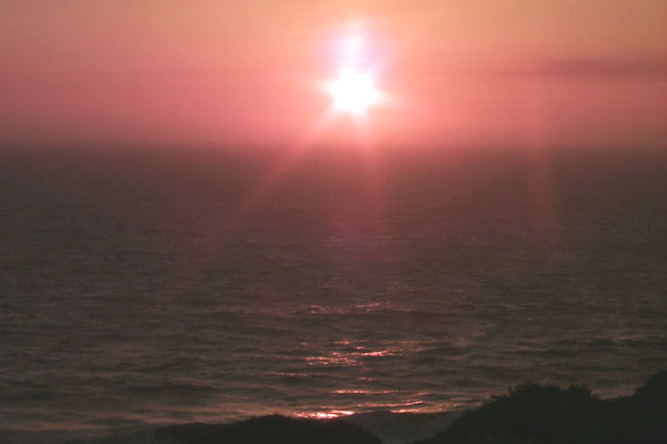
Sunset on the Sunset Trail, March 29, 2000.
see also: Comments at GGNRA Advisory Commission meeting 3/21/2000
-- especially those of John Cranshaw, Jeff Ward & Florence Sarrett.
"My Heart Is Broken" comments on Sunset Trail Closure